Denny Way Sediment Remediation Project
Information about King County’s project at the Denny Way Regulator Station (RS) Overflow to address historical sediment contamination near County combined sewer overflow (CSO) outfalls.
Posted May 2018
The Denny Way Regulator Station (RS) Overflow is identified under the County's 1999 Sediment Management Plan as needing cleanup. The plan evaluated remediation strategies for correcting hazards caused by contaminated sediments near seven King County combined sewer overflows (CSOs).
The Denny Way cleanup is being conducted in three steps:
- 1st Stage: Offshore cap – Completed 1990
- 2nd Stage: Inshore removal – Completed 2008
- 3rd Stage: Investigation to determine if any further cleanup is needed - Ongoing
A cap of maintenance dredging sediment was placed over contaminated sediment as a demonstration project in 1990. The work was a partnership of the U.S. Corps of Engineers, EPA, and Metro (now King County). Monitoring concluded the cap was stable and isolating the contamination.
King County then removed contaminated sediment in 2008 from one acre of the Elliott Bay floor offshore of Seattle's Myrtle Edwards Park (inshore of the cap) and backfilled the area with clean materials to enhance the marine habitat.
These cleanups are part of King County's continuing efforts to remove historic contamination and restore habitat in Elliott Bay.
The project site was contaminated by 40 years of CSOs. When flows exceeded the sewer system's capacity during heavy rains, diluted sewage mixed with storm water discharged from the Denny Way RS Overflow outfall. The site is no longer affected by the Denny Way RS Overflow due to a 2005 King County CSO control project which diminished the frequency of discharges and relocated the outfall and a new Elliott West Wet Weather Treatment System outfall further offshore. Following the removal of the old shoreline outfall, the shoreline contamination in front of the old outfall was cleaned up.
Project overview
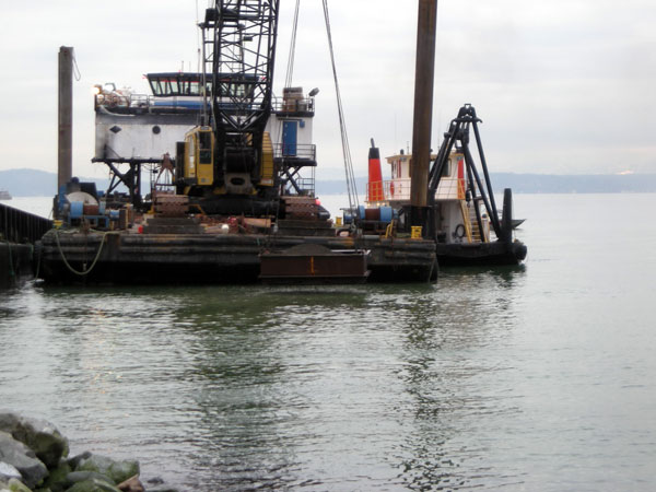
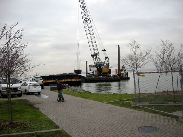
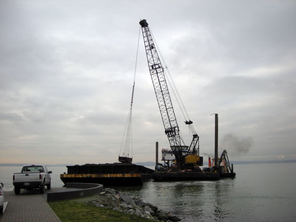
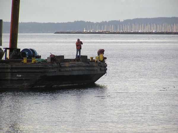
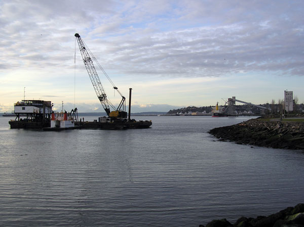
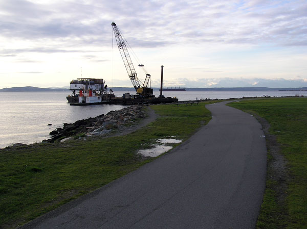
A mechanical dredge on a barge excavated the area and loaded a second barge with contaminated sediment. The second barge transferred the sediment to trucks and trains for transport to a landfill. Roughly 14,000 cubic yards of sediment was removed. After dredging, the excavated area was backfilled with clean sand, armor rock and habitat-enhancing gravel to match the seabed's existing grade and improve the site as shallow-water nearshore habitat.
King County is committed to protecting the environment throughout our cleanups. To reduce sediment dispersal and turbidity, King County crews used careful dredging methods that disturb the least amount of sediment possible. Transport barges carrying excavated sediment were lined with filters to limit contaminants draining into Elliott Bay. In addition, the project was scheduled to avoid salmon migration periods. Inspectors on site monitored water quality around the work area to ensure these precautions were fully employed and sufficient.
Vicinity map
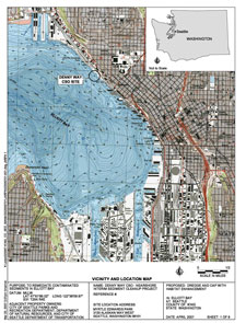
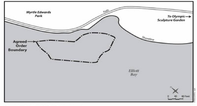
The project site is located along the northeastern shoreline in Elliott Bay and is adjacent to Myrtle Edwards Park at the foot of Denny Way in Seattle, Washington.
The Denny Way regulator station is located at 3165 Alaskan Way. The Denny Way historical RS overflow outfall was located along a riprap bulkhead on the shoreline. This outfall has since been removed, and a 2005 King County project now controls sewage and stormwater overflows near the shoreline.
|
Project library
Department of Ecology Reports
- Denny CSO Agreed Order Final, Nov, 2007
Cleanup Study Reports
- Toxicant Reduction in the Denny Way Sewer System, Oct, 1987 (3.2MB)
- Denny Way/Lake Union CSO Control Project Proposed Marine Outfall Sediment Characterization, May, 1998 (6.5MB)
- Denny Way CSO Control Project Sediment Remediation Plan, May, 1999 (3.7MB)
- Recontamination Sources At Three Sediment Caps In Seattle, June, 2005
- Sediment Monitoring Plan: Denny Way/Lake Union CSO Project, May, 2000
- Biological Opinion for the Proposed Denny Way/Lake Union CSO Control Project, June, 2000 (3.4MB)
- Pre-Construction Sediment Characterization Study Denny Way/Lake Union CSO Control Project: Sampling and Analysis Plan, March, 2001 (1.4MB)
- Pre-Construction Sediment Characterization Study Denny Way/Lake Union CSO Control Project: Sediment Profile Imaging and Video Survey Data Report, May, 2001
- Pre-Construction Sediment Characterization Study Denny Way/Lake Union CSO Control Project: Marine Sediment Chemistry Benthic Infauna Community Assemblage Profile Imaging and Video Survey, October, 2001 (7.1MB)
- 2005 Pre-remedial Design Sediment Sampling & Analysis Denny Way CSO, August, 2007 (1.4MB)
- Denny Way Combined Sewer Overflow Outfall Sediment Characterization, Appendices A-D: July, 2005 (5.7MB)
Closure reports
- Denny Way CSO Nearshore Interim Sediment Cleanup Project Closure Report, Oct, 2008 (52.6MB)
- Report, with no appendices (7.4MB)
Monitoring Reports
- The Denny Way Sediment Cap 1996 Data Final Report, May, 1999 (7.7MB)
- The Denny Way Sediment Cap 2000 Data Final Monitoring Report, April 2005
- Report (5.2MB)
- Tables 3-1, 4-1 and 6-1 (2.2MB)
- Denny Way/Lake Union CSO Control Project: Long-Term Sediment Monitoring Program, Areas A and B Nearshore Sediment Remediation Project, Areas C, D, and E Monitored Natural Recovery, March, 2008 (3.4MB)
Denny Way/Lake Union CSO Control Project Outfall Sediment Monitoring
King County is conducting a long-term sediment monitoring program for the Denny Way/Lake Union Combined Sewer Overflow (CSO) Control Project to fulfill requirements of the Biological Opinion issued by the National Marine Fisheries Service. The objectives of the Biological Opinion are to determine the nature and extent of chemicals of concern and the condition of the benthic community in the area surrounding the new Denny Way RS Overflow and Elliott West Wet Weather Treatment Station outfalls. The Biological Opinion required monitoring to identify any impacts from the construction and operation of two new offshore outfalls for the Denny CSO control project, and if any are found, to propose actions to address. The chemistry and benthic community data for program monitoring years 1–5 (2006–2010) and Year 10 (2015) are included in the monitoring report listed below. Although the monitoring program is not complete yet (monitoring years 15 and 20 will occur in 2020 and 2025), this report evaluates the current status of the Denny Way site.
Monitoring to date indicates the sediment contamination present in the project area is likely related to historic conditions prior to the initiation of the control project. Chemistry data do not show increasing chemical concentrations since discharges from the Elliott West Wet Weather Treatment Station began in 2005 and the benthic community data show little discernible impacts from the construction and operation of the outfalls.
Monitoring Report, April 2018
 Translate
