Historical King County government events
Renaming King County
The King County Council approved a motion on February 24, 1986, renaming King County after Dr. Martin Luther King, Jr.
Revised Code of Washington, current state law (RCW 36.04.170)
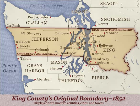
Original King County Boundary
The original boundaries of King County were defined in December 22, 1852, as follows:
Commencing at the northeast corner of Pierce County, thence along the Cascade Mountains to a parallel passing through Pilot Cove, then from the point last aforesaid west along the said parallel of latitude to the Pacific Ocean, thence south along the Coast to a point due west of the head of Case’s Inlet, beginning.

 Translate